MNC GEOSPATIAL

Precision Spatial Intelligence

Trainee GIS Engineer

Entry Level | 0-1 Year Exp

Job Description: Trainee GIS Engineer
Company: MNC GeoSpatial
Department: Geospatial & GIS Engineering
Job Type: Full-Time (Trainee / Entry Level)
Experience: 0–1 Year (Freshers welcome)
Work Mode: Work from Office
Location: L.B.Nagar, Hyderabad

MNC GeoSpatial is looking for enthusiastic and motivated Trainee GIS Engineers to join our Geospatial team. This role is designed for fresh graduates who want to build a strong foundation in GIS, mapping, and spatial data management while working on real-world utility, infrastructure, and mapping projects under the guidance of experienced professionals.

Training Details:
  • Duration: 1 Month
  • Training Charges: No Charges
  • Type: Full-time, In-office
Training Focus Areas:
  • Fundamentals of GIS and remote sensing
  • Working with ArcGIS / QGIS

After successful completion of the training program, candidates will be evaluated based on their performance and offered a full-time position as GIS Engineer.

Starting Salary: ₹10,000 – ₹15,000 per month (based on performance during training)
Education: B.Tech / M.Sc / B.Sc in Geography, Geoinformatics, Civil Engineering, Environmental Science, or Any graduate Interview
  • You can attend the interview from Monday to Saturday
  • Time: 11:00AM to 6:00 PM
  • Address: First Floor, Sri padmavathi Nilayam, Series Road, Opp lane: Kamineni Hospital L. B. Nagar, Hyderabad, Telangana 500074
  • Google Location
Apply Now
Who We Are

Pioneering Geospatial Excellence

MNC Geospatial stands at the forefront of digital infrastructure mapping, enabling utility and telecom leaders to build the future with absolute data certainty.
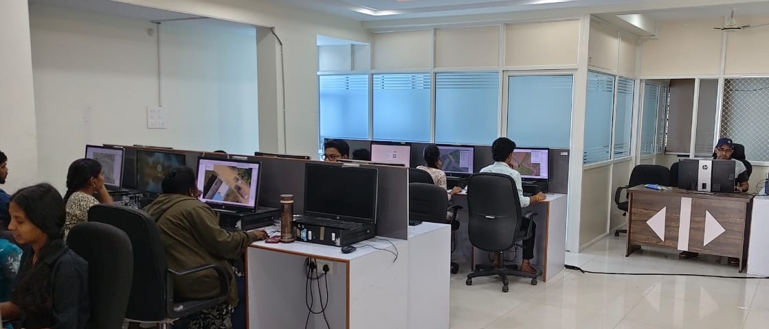
MNC Team
Our Mission

Strategic Purpose

To empower global infrastructure and utility sectors with high-fidelity geospatial intelligence, ensuring that every project is built upon a foundation of precision data, operational safety, and technological innovation.

Our Vision

Future Trajectory

To redefine the landscape of spatial engineering by becoming the primary global partner for digital twin creation and network mapping, fostering a world where infrastructure is seamlessly managed through intelligent data.

Our Capabilities

Core Expertise

Telecom & Fiber

  • Fiber Route Optimization
  • Make-Ready Engineering
  • Fiber Distribution Design

Electric Utilities

  • Distribution Network Mapping
  • Transmission Network Mapping
  • Fault Detection Mapping

Gas Distribution

  • Pipeline Asset Mapping
  • Compliance Digitization
  • Network Modeling & Pressure Management

Water & Sewer

  • Asset Management & Inventory
  • Water Supply & Distribution Network
  • Sewerage & Wastewater Network
  • Network Modeling & Hydraulic Analysis

Cartography

  • Thematic Mapping
  • Topographic Mapping
  • Cadastral & Land Record Mapping
  • Navigation Mapping

LiDAR Services

  • Airborne LiDAR (ALS) Services
  • Mobile LiDAR (MLS) Services
  • Utility & Corridor LiDAR Services
  • Power Transmission & Distribution Classification
  • Ground Classification
The MNC Advantage

Innovation in Data Integrity

We combine advanced AI with expert human verification to ensure total reliability for your infrastructure projects.

99.9% Accuracy

Flawless spatial truth for engineering models.

Global Delivery

24/7 support across all time zones.

Insights

Latest Articles

Electrical Utility Network Mapping with GIS

Read More

How GIS Is Transforming Utility Infrastructure From Mapping to Smart Networks

Read More

How to Detect Electrical Outages Using GIS-Based Outage Management Systems (OMS)

Read More
Join the Mission

Current Openings

LiDAR Engineer

Utility Mapping | 2-5 Years Exp

Senior GIS Engineer

LiDAR Services | 2–4 Years Exp

Trainee GIS Engineer

Entry Level | 0-1 Year Exp

Contact

Get In Touch

Email: [email protected]

Public domains (Gmail, Yahoo, etc.) are not allowed.